
G.P. Stout Historical Research Maps of North Carolina
Researched and drawn by Garland P. Stout, C.G., F.A.C.G., H.L.C.
Category:
Post Route 1896
This map shows every post office open in 1896 and the routes between them with distances. Every part of the state had been settled and this map shows even the most remote hamlet. (29 ¼” x 19 1/8; 1” = 18 miles)
Bute County 1764-1779
Bute County 1764-1779
Davidson County 1890
Copy of L Johnson's 1890 map of Davidson County
Alamance County 1893
Copy of Wm L Spoon 1893 map of Alamance County
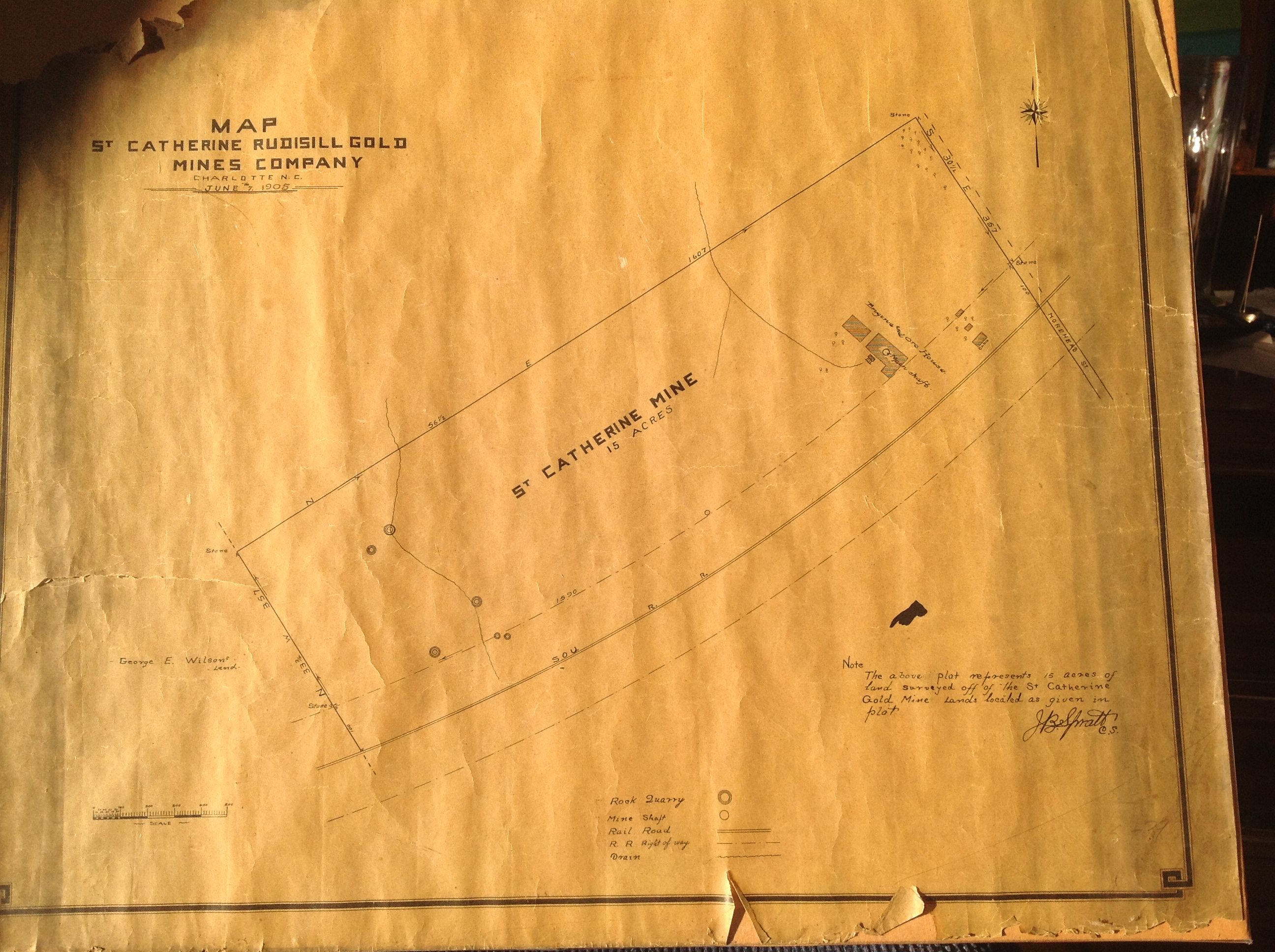
St. Catherine Mine
24 x 20.5, paper map, Showing St Catherine Mine located on Morehead St. (across from current Bank of America Stadium). Shows main shaft, and open pit mines, located north of Southern Railroad tracks. Fair condition, for paper map.
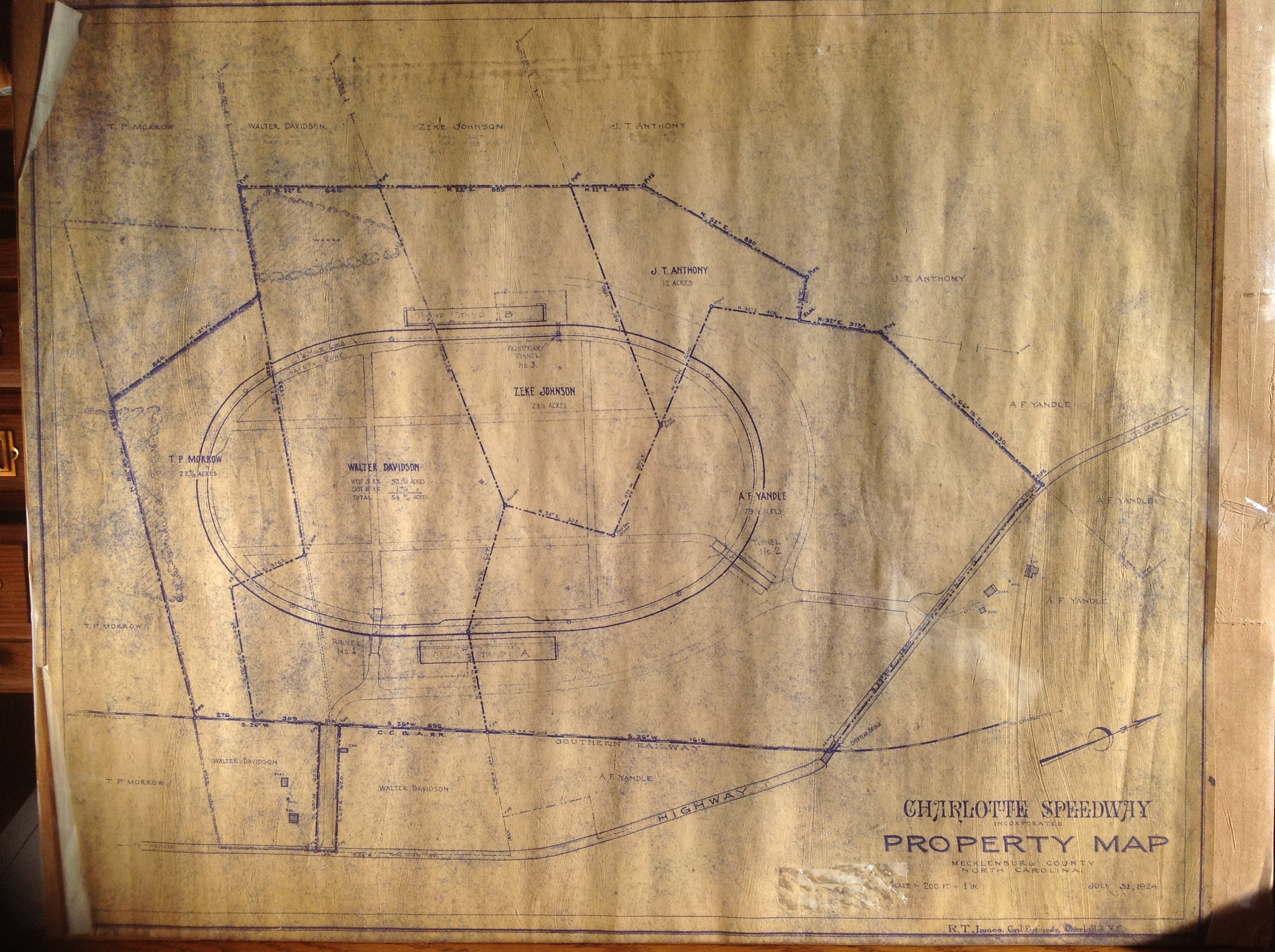
The Charlotte Speedway 1924
This positive blueprint shows the Charlotte Speedway, which was located just north of Pineville, NC. The 1.25 mile oval was made of cypress and green pine and cars reached speeds of 150 mph.
Millstone Drink Coasters
Millstone Drink Coasters, set of 4